
Our Services
Our interdisciplinary team specializes in bringing projects to life. From planning, to permitting, to development - we assist in all phases of project management.

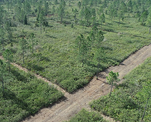
High-resolution topography, corridors, and volumetrics — from above.
Drone-mounted LiDAR and photogrammetry for sites from a few acres to multi-mile corridors. Sub-centimeter vertical accuracy. Classified point clouds, DTM/DSM, contours, and CAD-ready linework as standard deliverables. Captures true ground elevation through tree canopy where photogrammetry can't.

Scenario modeling and site visualization for early-stage decisions.
Conceptual layouts and 3D renders built directly from constraint maps and site data. We model two or three development scenarios per project — varying density, footprint, and conservation approach — and quantify the regulatory and cost trade-offs of each so clients can see what fits before they commit.

Portal deployments, field workflows, and automation.
ArcGIS Online and Portal configuration, including Field Maps deployments for field crews, role-based access design, and governance frameworks for organizations scaling beyond ad hoc map use. We also build Python automations — scheduled backups, data pipelines, agency integrations — that keep GIS infrastructure running unattended.

FWC-authorized surveys, relocations, and recipient site services.
Gopher tortoise burrow surveys, captures, and relocations — including direct transfers to our own White Sands Ecological Preserve Recipient Site. We also conduct listed species surveys, habitat assessments, and prescribed-burn-supported land management for development and conservation clients.

Tripod-mounted laser scanning for buildings, bridges, mechanical rooms, and historic structures.
Deliverables include registered point clouds, scan-to-CAD linework, and Revit-ready BIM models. Built for renovation teams, historic preservation, structural assessments, and research programs needing precise geometric documentation of built environments.

Research Support
Field data collection for academic, agency, and consultancy studies.
Listed species presence/absence surveys, habitat assessments, vegetation transects, hydrology characterization, drone-based water quality sampling support, drone-based change detection, drone-based bathymetry, groundwater monitoring and long-term monitoring deployments.
Portal deployments, field workflows, and automation.
ArcGIS Online and Portal configuration, including Field Maps deployments for field crews, role-based access design, and governance frameworks for organizations scaling beyond ad hoc map use. We also build Python automations — scheduled backups, data pipelines, agency integrations — that keep GIS infrastructure running unattended.

FWC-authorized surveys, relocations, and recipient site services.
Gopher tortoise burrow surveys, captures, and relocations — including direct transfers to our own White Sands Ecological Preserve Recipient Site. We also conduct listed species surveys, habitat assessments, and prescribed-burn-supported land management for development and conservation clients.
Get a Quote
We’re dedicated to turning your unique projects into reality. Our expert team combines creativity, technical expertise, and industry knowledge to provide tailored solutions that meet your specific needs. Contact us so we can create together.